Friday, November 30, 2007

San Francisco Culture

Chapter 13: Culture
View from Bernal Hights
Golden Gate Park

There has been much mention in previous blogs about the cultural diversity and many ethnic groups that have given San Francisco its character, and continue to do so. The Northwest region of the United States (Oregon, Washington) is known for its environmental consciousness, to which San Francisco and most of Northern California is a part of. Overall, this area attracts a different kind of person, one who is not looking for a New York or Las Vegas. Although these states contain bustling metropolitan cities, they are nestled between acres of natural landscapes and wildlife preserves. This area is more about community and life-style and social tolerance.

Castro Street

Sun Bathers in Dolores Park (nowhere near the beach!)

Since I was young, places like San Francisco, Eugene, Oregon and Seattle, Washington have captured my attention as places I would like to move. I am a born and raised in Los Angeles girl, but the older I get, I just do not feel that I get this city, or that this city gets me. In doing this blog, I have only reinforced my draw to the North. I hope the move happens when I finish my degree! SOON!

A block on Valencia Street

San Francisco Neighborhoods


Chapter 11: Neighborhoods

Even though San Francisco is a small sized city, there are many different neighborhoods or districts that exist, each with a distinct style and flavor. I've written a little about each area based on the map above.

District 1 – Richmond/Laurel Heights

This is the area where Golden Gate Park resides and the Presidio. It is also popular for its many critically acclaimed restaurants and shopping. Historically it was a Jewish and Italian area, but after WWII it became more Chinese, to which it is now referred to as the “New Chinatown.”

District 2 & 3 – Sunset

This district borders the south of Golden Gate Park. It is a primarily residential area built on a grid. It contains the campus of the University of California, San Francisco, and is called to as “The Avenues.”

District 4 & 5 – Castro/Noe Valley – Twin Peaks

The Castor is probably best known as the “Gay” area of the City, but because of many Victorian homes, it does contain “straight” residents and families. In fact, there is a gentrification of young families with children moving in the last few years. Historically it was dairy farms and dirt roads, inhabited by Mexican land barons and European homesteaders. It is now a popular place for late nightclubs and is one of the safest neighborhoods in the City.

Noe Valley is a socially/shopper friendly place. It is filled with family residences with a mixed economic and political diversity--, from working class, dot.comers, millionaires, and Hollywood film crews, liberal and conservatives alike. It was named after the last Mexican Mayor of the area Jose de Jesus Noe. Though gentrification, property has risen to the millions.

Twin Peaks is named after the two hills that sit in the surrounding neighborhood. The peaks themselves, 922 feet high, 31 acres of undeveloped land. It is a popular hiking spot and contains a bird sanctuary.

District 6 & 7 – Marina/Presidio – Pacific Heights – The Height-Ashbury

The Marina was developed after the big earthquake of 1906 (in fact there is a myth that the area was built on dumped rubble from the earthquake). It is filled with upper scale apartment buildings and restaurants. Historically, this is the area where Native Americans resided.

The Presidio which sits in the Marina neighborhood used to be a Spanish Military base. It is now a historic landmark, run by the Golden Gate Park National Park.

Pacific Heights is the most luxurious of all the City’s neighborhoods. There are Victorian mansions, which were built after the earthquake, and you’ll find some of the greatest views of the whole City. For this reason, it is a tourist attraction.

The Height-Ashbury district is another well known district as the Hippy Mecca in the 1960s. There are actually two streets that intersect named Height & Ashbury for which it gets its name. The bohemian hippy subculture mentality still prevails in this area, although some mainstream stores do exist here, it consists of mostly indipendedntly own stores.

District 8 & 9 – Fishermans Warf – Chinatown/North Beach – Russian/Nob Hill – Downtown – Soma/Potero Hills – Mission/Bernal Heights

This area is the most commercial and tourist visited area. Fisherman’s Warf and Downtown contain many, many mainstream stores and tourist kitschy stores. Union Square in downtown is literally a square park flanked by mounds of department and fashion stores. One can ride the famous cable cars around this area. Despite its tourist appeal, it is an entertaining area.

Chinatown, although visited by tourist, does not really cater to tourist, per se. It is a thriving Chinese community. Statistically it draws more tourist than Golden Gate Bridge!

Russian Hill is a mostly residential neighborhood, charmed by coffeshops, unusual stores and antique shops. The famous crooked street, Lombard, runs down the hill. The place got its name from goldminers who discovered several tombstones containing Russian writing on them. The best guest of their identity were fur traders or sailors. The tombstones were never preserved and lost, but the nickname “Russian Hill” stuck. The names does not imply a large Russian community here. The actual Russian community in the City exist in the Richmond district.

Noe Hill is another highly affluent area, probably the first rich area that comes to mind in San Francisco, mainly because this is where the “old money” resides (for this reason, and it is easy, it has the nickname “Snob Hill”). Rows of mansions fill the streets. It is also famous for the many movies that have been filmed in the area such as “The Rock,” “Vertigo,” “Dirty Harry,” and the 1980’s TV series “Full House.”

The Mission district is where the “spice of life” is. For one, it is the highest concentration of Latin Americans (and their ethnic foods, i.e. Salvadorian, Nicaraguan, Mexican) and figuratively because of the many popular nightclubs that line Valencia Street. It is a artsy/hipster place and reminds me a lot of Echo Park/Silverlake in Los Angles, only cooler, lol!

Bernal Heights is the forgotten area of San Francisco, situated to the South of the Mission district. It is a quiet neighborhood that attracts artist, progressives and has a large lesbian population. It is attractive to first homebuyers and dog lovers, as it is one of the few areas where you can get a house with a small yard (most houses in the City lack yards, and apartments do no contain yards). Through gentrification, it has lost its reputation as being a dangerous area filled with drugs and violence. Historically this area was a rancho owned by Jose Cornello de Bernal and during the 1906 earthquakes this area did not suffer as much damage due to the fact that it sits on a bedrock foundation.

District 10 – Excelsior/Bayview – Hunters Point

Excelsior district is an area that runs along south of Interstate 280, with its intersections being Mission Street and Ocean Avenue. It is the most ethnically diverse area. The area over the years has tried to gain attraction through development and entertainment festivals that celebrate its diversity and present culture. Gerry Garcia of the Grateful Dead grew up in the area, so there is a “Jerry Day” celebration near his birthday, August 5, attracting thousands yearly. The McLaren Park Amphitheater was renamed the Jerry Garcia Amphitheater on July 21, 2005. This is where Jerry Day is held.

Bayview is a small district that stretches along Third Street, south of Evans Avenue. Its Neighborhood History Preservation Project is housed there. There are urban gardens and public art projects that have been developed entirely by the residents, who are organized and call themselves the Quesada Garden Initiative.

Hunters Point is west of Bayview is home to the Shipyards. It also boasts the warmest area in the City. It also contains toxic waste yards (wonder if that affects the climate). Since the 1950’s it has been a Afro-American community, Blacks who migrated from the Southern states seeking work in the shipyards.

Wednesday, November 14, 2007

Human Impact on the Environment

Chapter 12

San Francisco is filled with National Recreation Parks, this has influenced the city to be very environmentally concieious. I am sure that this environmental conciousness was present before the hippies of Haight and Ashbury back in the mid-1960s, but I am sure that some of their lifestyle that involved getting back to nature has influenced present day environmental conciousness.

One may visit San Francisco’s Department of the Environment’s website to see just how serious they are. <>

Recent Oil Spill in the Bay

Oil Surrounding Alcatraz

A huge oil spill occurred in the San Francisco Bay on November 7, 2007. 58,000 gallons of oil seeped from an 810-foot-long containership as a result of it smashing into the base of the Bay Bridge. The Bridge suffered no structural damage, but wildlife will be in trouble for the weeks to come. On another economic level, the commercial crab season was coming up, but due to the spill, it has been postpone. It apparently was a bad fishing summer season, and now this.


An oil broom pulled up from the waters.


In the first few days, there was an overwhelming response of citizens volunteering to help clean up the oil spill, however they were turned away for safety reasons–the oil is just too hazardous for untrained people to handle. Training of this kind can take only 24 hours, but at the time, there was no time or offical trainers set up to train volunteers. The City of S.F. has about 150 specially trained municipal workers in this line of work, to help clean the beaches, but the Coast Guard has been reluctant to call on them, stating that they have it under control. Early this week of November 11th, the Coast Guard recognized that it as well as state and federal agencies were ill prepared to handle volunteer requests, and realize they lost out on a great resource those first few days. In response, the California Department of Fish and Game held instructional session for volunteers.

Those first eager citizens were given grunt work to do for Oiled Wildlife Care Network (www.owcn.org), an organization of UC Davis who are helping to save the birds. Citizens are not washing birds, but they are helping with food preperation, cleaning equipemtna and bird pins. (Fun fact: Ultra Dawn dish soap is what is being used to wash the oil off the birds, because it has been proven to work the best of them all. Proctor & Gamble, makers of UltraDawn have donated 30 cases of 22-ounce bottles for OWCN’s current work).


A volunteer picks up an oil-slicked bird

Here is one of the better articles pertaining to this incident, with a link that has a audio podcast of the Coast Guard talking with the newspaper The Chronicle, along with photographs
http://www.sfgate.com/cgi-bin/article.cgi?f=/c/a/2007/11/13/MNO2TB3AV.DTL&hw=oil+spill&sn=022&sc=573

Clean Technology

San Franciscos biggest economy draws are technology, biotechnology, health care, and telecommunications, in addition to tourism. But another technology of special interest to venture capitalist has been Clean Technology. What is meant by Clean Technology are innovations such as hybrid/electric vehicles, wind power, solar energy, and energy efficient building design. The Mayor of San Francisco has an initiative that works with the an advisory council to help put San Francisco at the hub of this business and job attraction strategies, and help establish public-private partnerships in this industry.
< ssi="12">.

Tuesday, November 13, 2007

Recreational Resources


Chapter 11


What are the City’s recreational resources?

Although San Francisco is 7miles x 7 miles, there is an amazing amount of things to do. Because it is a walking city, and transportation is plentiful and constant, it is easy to get around. For instance, I live 10 miles away from my job here in Los Angeles. I have taken the bus before and with our MTA it takes 2 hours to get there because of the poor frequency of buses. I have taken the bus, light rail, trolley, or BART from one end of San Francisco to another, and it is anywhere from 30-45 minutes.

According to an article in Outlook Magazine's quality-of-life report , San Francisco ranked #1 nationally in nine categories: arts, health, recreation, transportation, education,climate, economy, safety, and housing. San Francisco ranked first in the arts, second in health and
recreation, and fourth in transportation.

The City contains many National Recreation areas. One of the biggest and best getaways is Golden Gate Park, a National Park. It is a little over 1,000 acres in the middle of the City and is larger than New York’s Central Park. It starts, or ends depending on how you look at it, at the beach and stretches into San Francisco. There are numerous things to see here other than just green grass and trees; there is a botanical garden, the Striping Arboretum; the Japanese Tea Garden, where you can have Japanese tea service in a traditional Japanese wooden patio overlooking the carefully laid out and beautifully manicured garden and pond; the only national AIDS memorial called the AIDS Memorial Grove; two lakes, Stow Lake and Spreckels Lake where you can rent rowboats and where you can race radio controlled boats; it contains two museums, the De Young Art museum and the Academy of Sciences, one of the largest natural history museums in the world which also houses an aquarium and planetarium; Kezar Stadium is also located here, in the southeast corner of the park, the former home of the Oakland Raiders and 49ers–it now host amateur sports, high school football games, and is the home to the San Francisco Dragons, a lacrosse team.

The Golden Gate National Recreation Area is not a continuous location, but there is a collection of areas all over the San Francisco Bay Area. Some of the more popular areas are: Alcatraz, the Presidio, Ocean & Baker Beaches, and Land’s End.

Additional recreational things to do in San Francisco are sight seeing places like China Town, Coit Tower, Lombard Street (the curvy brick street), jumping on one of the public transpirations and seeing where it takes you. For shoppers and real tourism, you can go to the Embarcadero and Fisherman’s Warf where there are loads of stores, seafood restaurants; Giant’s Stadium is located on that side of town.

One of my favorite things to do in San Francisco is eat. There are so many great places to dine. Just like Los Angeles, they have every ethnicity, but it’s all in walking distance or a hop on the bus: Indian, Asian, Little Italy, Russian, American, or British just to name a few.

More about The City


Chapter 9


What kind of urban city is SF and what makes it urban?

San Francisco is the 14th most populated city in the US, and the 4th in CA. Its situation and site one of the most densely populated in the US, with a little over 750,000 people at the tip of the San Francisco Peninsula (37°46´0´´´N 122°26´0´´W). The City is 54 feet above sea level at the edge of the Pacific Ocean to its west, and the peninsula creating a bay to the east, known as the San Francisco Bay. The San Francisco Bay Area which is made up the cities that surround the San Francisco Bay contain at least 7 million people.

There are several smaller islands that are part of the city and sit in the Bay. Most famous of them all is Alcatraz. There are also a set of islands located 27 miles to the west of the City in the Pacific Ocean called the Farallon Islands, which are uninhabited.

San Francisco is a metropolitan area. According to our text, the definition of metropolitan area is “a large-scale functional entity, perhaps containing several urbanized areas, discontinuously built-up but nonetheless operating as an integrated economic whole.” San Francisco is a part of the conurbation known as the San Francisco Bay Area, which is a part of the Cities of Oakland and San Jose, and including the counties of Alameda, Contra Costa, Marin, Napa, San Mateo, Santa Clara, Solano, and Sonoma. According to the text, San Francisco ranks 5th in the largest Metropolitan area in the U.S.

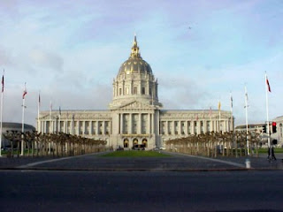
Although San Francisco was not fully built up before 1850, it followed a city planning structure like that of New York or Boston, a very pre-1850, East Coast city structure; it is very much a walking city. Yerba Buena was the City’s first name. The first homestead was put up in 1835 and it was built up around the Mission Dolores settlement by the Spaniards in the 1770’s. Yerba Buena started to attract Americans. It was claimed for the U.S. during the Mexican-American War in 1846 and renamed San Francisco. By then, the California Gold Rush brought in many settlers. The City grew in one year from 1,000 to 25,000 people. Because of the gold coming in, there arose a need for banks. San Francisco in its early years was a banking city. And where there is money, there is strong politics, and that too is very evident by their stunning City Hall and, even today, thriving Civic Center.

Although this chapter does bring up ethnic and racial distribution, segregation, and gentrification, I believe that these topics can be better explored in chapters 10 & 13 when talking about neighborhoods.

Sunday, October 28, 2007

Transportation

Chapter 8

San Francisco, like most other major cities, relies on transportation for goods and public transportation. The City was thought important enough to make major highways, rail systems and air lines a large part of the transportation system (i.e., U.S. Highway Route 40).

The City also cares much for their public transporation. I think that this is one of the reasons, like New York, that San Francisco is so popular and successful as city and major tourist attraction. People that I know who have visited Los Angeles, as well as locals, realize that one can barely get around Los Angeles without a car. For a tourist to come here, they either have to know someone to take them around, visit only certain areas that they can walk to, or have a great sense of direction to drive themselves around!

But in San Francisco, you can get lost, but you are never far from a MUNI bus, a BART Subway station, or one of the light rails M, T, J, K, N, to name a few. And its affordable too.

This is a picture of a MUNI bus.


This is a picture of a light rail (LRT).


Public Transportation is the best choice for the City because of its limited space, therefore, lack of parking. If and when I have drove my own car there that is the biggest problem–trying to find parking! I usually ditch my car somewhere and then take the MUNI everywhere else. Not to mention traffic!

A famous Cable Cars of San Francisco (anyone remember Rice-a-Roni?)

The MUNI (Municipal Railway), which oversees the buses, trolleybus, light rail, street and cable cars, began its operation in 1912, 7 days a week, 365 days of the year. There are some MUNI buses that are electric, and others that run on ethanol. All light rails are electric. Many bus lines also have night owl services.

The BART (Bay Area Rapid Transit) is the heavy rail part subway system that covers in the City and the surrounding Bay Area (Richmond, Oakland, etc.). It began operation in 1972.


San Francisco is always working to improve their transit. As of this year, they added the light rail T line, which services the southeast side, making sure that lines hit key places such as Giant’s Stadium, the 49ers stadium and The Embarcadero.

Economy

Chapter 7

Although SF has had a long, rich economic history, the most fascinating economic “boom” is the Silicon Valley.

Stanford University, located some 35 miles south of San Francisco City, was the birthplace of technology. As early as the 1950’s, Stanford had some of the top minds of technology researching and developing. Innovation was happening at Stanford. From here, IBM, Apple was born. Research funding money was thrown at many companies to create and develop. This place, which became to be known as Silicon Valley (first used in 1971), became a very distinctive and new cultural place of our time. Although Silicon Valley is not the only place in the world to be a city where its culture is rooted in creation of technology, it was the first of its kind.


According to our book, Manuel Castells, a sociologist who researches information and communications, has described this kind of characteristic city which has popped up world wide as “milieus of innovation.” This describes an urban areas who’s main goal and function is to generate new knowledge and products. Certain conditions such as centers of research and development must exist; access to a large pool of innovators or scientist; and the availability of capital.

So how does the city of San Francisco have anything to do with Silicon Valley? San Francisco is not the place where parts for these technologies are manufactured; parts are relatively light, therefore production can happen mostly anywhere, economically, and transported at a low cost. Silicon Valley is not a bustling metropolis. It is safe to say that most people are attracted to cities that have a lot of amenities to offer such as entertainment and cultural scene, therefore, the closest city that fits these desires is San Francisco, only 35 miles to the north.

With the influence of Silicon Valley, San Francisco kind of had its own milieus of innovation: the dot-com company (1995-2000). These were companies that presented themselves on line and offered unique services to the web-surfer. Anything from gaming on line, toy stores, bookstores, and independent internet companies, just to name a few. But they all had one motto in common: get big fast!

Dot-com companies and new Silicon Valley residents is how San Francisco was affected.

The adverse effects of this was a loss of many jobs when the dot-com’s became dot-bombs (around the year 2000) due to over spending and getting big too fast; and the displacement of long time residents by wealthier people from Silicon Valley and the dot-com’s moving in, which caused property to increase. This moving in of the more wealthy which caused real estate to soar, displaced lower income residents, such as cooks, janitors, waiters, teachers, those who help the daily function of the City work. The latter were now commuting into the City they served, living elsewhere, while the wealthy were driving out of the City to their jobs in Silicon Valley.

Long time residents of the City who survived the dot.com/Silicon Valley craze are now seeking to restore San Francisco to a place of character and diversity, not just a place for the rich.

Industry

Chapter 6

The origins of SF were a city. It never began as an agricultural community that in time became a metropolitan. They are not known for their primary activities. However I did find an interesting article on line from a Canadian agricultural magazine, published in 1999, about how the City is doing urban farming, and being quite successful on a small-business level

As for the City’s natural resources, they have their surrounding landscape like the beaches and Golden Gate Park.

Tourism is one of the primary industries. The most recent numbers from 2006 estimate that the City attracted about 15 million visitors. Hotels, restaurants, shops and attractions fall under this flag of “tourism.”

Recently, there is a lot of concern for what is named the “light” industry. It is being threatened by land developers who are greedy. “Light” industry consists of small suppliers, warehouses, and specialty manufacturing. There is also another article of interest which states: “Industry has declined but also has morphed into different types of activities. It has a different place in
the economy than it did in the 1950s. But this does not mean that it’s dead or not viable.”

SF Economic structure was once dominated by corporate headquarters. Many Fortune 500 companies were located here, but in the recent years have left to lower cost areas. Their economy is not associated with more smaller, innovated companies.

Future projections are that, despite the rise and crash of the dot-comb’s of 1995-2000, high technology industries will continue to grow in the Information and Computer Technology field.

The City's Governement


Chapter 5


Because the United States is a republic federal democracy this means that the central government gives States the power to handle their own tax, police force and the like. From the Governor all the way down to a city council member, these offices are voted by the people, not appointed.

San Francisco has a unique municipal government.

Most cities use the mayor-council system, where the mayor is elected citywide, but the council members are appointed by are elected by council districts. Mayors appoint heads of departments.

Another approach is the commission and council-manager system, where the voters elect a city council, who in turn, selects a mayor from its membership. According to the book, half of all U.S. cities us this approach.

There are less than three percent of cities who use a mayorless system. The city commission plan is where voters elect a commission board to be responsible for administration of the city.

Then there is a form of government that few cities use called metropolitan government. This is a two-tier government. The mayor and city officials handle the local functions while the metropolitan performs more area-wide functions, such as public transportation and pollution control.

This is the one that San Francisco practices, and has since 1856. It is the only one of its kind in California. There are two co-equal branches: the mayor is the county’s executive and the county’s board of supervisors acts as the city council and legislative branch. Both are elected by the people. The best I can figure is that the Mayor’s office oversees programs and initiatives for the City, and the Board develops City policies, adopts ordinances and resolutions, and manages urban issues.

I read that the Federal Government uses the City as a regional hub for different federal bureaucracy, such as the U.S. Court of Appeals, the Federal Reserve Bank, and the United States Mint. I am not sure what that means.

Also interesting to note that the State Supreme Court is located in San Francisco, including other State Agencies. No wonder why people don’t think that Sacramento is the Capitol!

Here is SF's offical government site, beginning with the Mayor's bio: http://www.sfgov.org/site/mayor_index.asp?id=22014 He is the youngest Mayor in 100 years! Pretty handsome guy.


Friday, September 28, 2007

The Morning Fog Chills the Air

Population – Chapter 4

The City is the second most densely populated city in the U.S.-–16,000 people per square mile. It is considered a metropolitan area with a population of less than 1 million. It has had a steady rate of increase since its incorporation to the U.S., the biggest population increase corresponding the Baby Boom of the 1950s. Since, it nearly has had zero population growth. The population is pretty much 50/50 whites/non-white, with Chinese being the largest ethnic group.

The City is still a center of banking. In addition to this, there are many tertiary activities as well as quaternary activities, with tourism being one of the major players in its economy and a rise in biotechnology and biomedical research centers.

Amenities

Because the City’s major economy is tourism, you can find some of the best entertainment and centers for shopping. Its public transportation is one of the best anywhere, which enhances its tourist trade. Some of the best centers for shopping are Union Square, near the Financial District and Fisherman’s Warf. These two districts are located right off the Bay Bridge, in the North East side of town. Chinatown is another popular tourist attraction, the cable cars, Lombard Street (the windiest street ever), Alcatraz, numerous museums and performing art centers like the historic Fillmore (made famous by Billy Graham, evangelist, but legendary bands such as Grateful Dead and Led Zeppelin have performed here) or Cow Palace (another place of performing legends like The Beatles, Kiss, and Elvis). And two famous sports arenas: Candlestick Park (49ers) and AT&T Park (Giants).

Golden Gate Park and the beaches are also wonderful attractions to visit, with some of the most breathtaking hiking trails along the sea cliffs and different unique gardens.

Wednesday, September 26, 2007

Where Little Cable Cars

Settlement – Chapter 3

The City, as locals will call it (and they despise "San Fran" or "Cisco") was established in 1776, the same birth date as the United States, recently freed from British rule. San Francisco was a part of Spanish Territory.

San Francisco was home to a large population of indigenous people at the time of Spanish settlement. A Catholic Mission was set up (
Mission Dolores) in the area in an attempt to proselytize the Natives. This building still exist today.

In 1821 San Francisco became part of Mexico and then a part of the United States in 1849.

The California Gold Rush of the mid-1850s brought a population boom for the city. In one year they rose from about 1,000 residence to 25,000 (The Gold Rusher's were also the originators of sourdough bread, for which San Francisco is famous for). Because of the Gold Rush, San Francisco became a banker's city and highly
urbanized (Bank of America was born here).

In 1906 the City experience their worse earthquake to date that leveled it to the ground
and set the city on fire for days. The population at that time was 400,000 and over half lost their homes. However, within less than 15 years the City rebuilt and was stronger than ever. So strong in fact, that when the stock market crashed in 1929, not one bank fell victim.

As small as San Francisco is, it represents many different races and cultures. Its Chinatown settlement is the oldest of its kind in the nation, with the first Chinese immigrants to arrive in 1849. The City also contains a Little Italy, Japantown, Russians near Golden Gate Park, and Latinos in the Mission district just to name a few. Many of these areas have had economic ups and downs. Some thrive more than others, and then others get revived for a time. Only the very affluent areas such as the Financial District or Nob Hill remain constant.

State Flag information: http://www.ci.sf.ca.us/site/visitor_index.asp?id=8081


High on a Hill...


Physiography – Chapter 2

San Francisco is a tightly packed city, with houses stacked up against each other. There are many rolling hills containing such houses in addition to streets, electric street cars and subways. Despite the City's urban setting, there are substantial areas of land on this peninsula where one can escape from urban life such as Golden Gate Park, the Presidio, the beaches, in addition to the smaller parks located throughout the City.

San Francisco contains many hills. The neighborhoods are named after the hills they were built on: Nob Hill, Telegraph Hill, or Russian Hill. The highest hill within city limits is Mount Davidson, standing at 925 ft. This hill is located near Twin Peaks, located in the southwest area of the city. Twin Peaks however is not populated, but is a city park and tourist attraction. It is easily identified by its red and white radio tower.

Being a peninsula does not mean it is alone out in the ocean. There are a few smaller island that surround San Francisco. The most famous is Alcatraz ("Welcome to THE ROCK"), where the federal prison was until 1962. It is not a state park and tourist attraction accessible only by boat. Treasure Island is another well known island you can visit, located and accessible along the Bay Bridge which connects San Francisco to Oakland. This island is man-made, a result of dumped dirt from Yerba Buena Island, when they tunneled through it to create the Bay Bridge.

San Francisco lies along the Coast Range of mountains. These mountains make contact with two earth plates under the ocean. This contributes to two earthquake fault lines that run near the City: the San Andreas and Hayward Fault, both responsible for the 1906 and 1989 earthquakes.

The City's coast and beaches exist, but are not like that of Southern California. The ocean waters rarely warm up enough to swim in and dangerous rip tides prevent leisurely swimming.

The native trees are Giant Redwood conifers. There are no rivers or natural lakes that run through the city. The flora and fauna seen throughout the city for the most part is man-made. Thousands of non-native plants were planted in Golden Gate Park, which was once a barren, sandy dune.


Monday, September 24, 2007

My Love Waits There


General San Francisco Information
(Chapter 1: Introduction)

Size: 47 square miles – you can drive it in an hour or less. This makes public transportation so easy.

Location:
The City (as locals call it, not “San Fran” or “Cisco”), is located in the Northern half of California. It is practically an island. The only way to get to it is from bridges to the North, South, and East of it. It is considered a peninsula.
Live CityCam Link:
http://sfgate.com/liveviews/baybridge.shtml

Population: 776,733 – compared to Los Angeles’ near 4 million people!

Density (2000): 16,526 persons per square mile – more crowded than Los Angeles, who’s density is half this.

Climate: This is the major reason why I love this place! I love cold, but not that cold. I like warm, not hot. Even in summer, you can get fog and light rain mist and need a jacket. That is a peninsula for you! A nice constant Pacific Ocean breeze, clean air guaranteed.

Technically speaking, winters the City are wet and mild, with average highs in the 60's, snow. very rare. Summer average highs are in the 70's.

San Francisco experiences a lot of fog because the land east of it does tend to get very warm. Although there is an average distance of about 5 miles between the City and the mainland, temperature on the mainland can be up to 20 degrees higher or lower. This heat meets with the cool ocean air to create San Francisco's legendary fog!

Weather link:
http://www.sfgate.com/weather/

Natural Resources: San Francisco contains no exploitable materials such as soil, minerals, or raw energy for economic gain. Tourism is the closest thing to a major exploitable resource. The Gold Rush of the 1800's helped San Francisco become a banking/financial city (Bank of America was born there). The Port of San Francisco was once a major area of commerce, but by 1930's the port closed and has since been developed into a major tourist attraction called The Embarcadero.


My Heart


"I left my heart in San Francisco
High on a hill, it calls to me
To be where little cable cars
Climb halfway to the stars!
And the morning fog will chill the air

My love waits there (my love waits there) in San Francisco
Above the blue and windy sea
When I come home to you, San Francisco,
Your golden sun will shine for me!

I left my heart in San Francisco
High on a hill, it calls to me
To be where little cable cars
Climb halfway to the stars!
And the morning fog will chill the air

I don't care

My love waits there in San Francisco
Above the blue and windy sea
When I come home to you, San Francisco,
Your golden sun will shine for me!"

I first heard this song when I was 9 years old. I found the song in a collection of 12” vinyl of my parents. I first went to SF when I was 19 years old, in 1993 – the song made perfect sense.

At the request of my Geography 321 professor, I have picked a city in the United States to explore, and one that is dear to me.